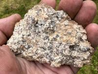
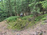
Křemenná žilovina u sv. Mikuláše
General Characteristics
County (administration):
Karlovarský kraj
District (town):
Sokolov
Village:
Horní Slavkov
Cadastre:
Třídomí
Map sheets:
11-23 Sokolov, 11-231 Horní Slavkov
Accessibility:
entry permit for car necessary
Technical object:
old mine workings
ID:
4466
Geology
Short characteristics of the site:
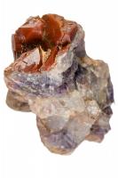
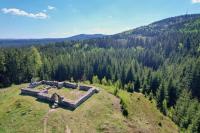
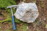
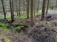
Ruins of the Church of St. Nicholas, traces of mining can be found in the surrounding area. The bedrock of the ruins of the Church is made up of medium to coarse-grained, weakly porphyric, predominantly biotite granites of the Ore Mountains pluton with the occurrence of quartz veins. Their filling is made up of jasper, quartz and in places also amethyst. There are unconfirmed assumptions that jasper and amethyst were mined here as precious stones in the Middle Ages (Rojík 2016). Even today, fragments of quartz vein fillings can be found, especially under the ruins of the church in the valley of the stream.
Regional geologic unit:
Bohemian Massif > Saxothuringicum > Krušné hory Mts. (Erzgebirge) Pluton
Stratigraphy:
Devonian - Permian
Subject:
geology, history, mining and mining impacts, building and decorative stone
Geological phenomenon:
vein, mineral
Genesis:
hydrothermal mineralization, magmatic
Rock:
granite, quartz vein
Territorial protection
Level of protection:
Interesting geological localities in Protected landscape area
Part of LEPA (Large-size especially protected areas):
Slavkovský les
Part of national geopark:
Egeria
Conflicts of interests:
forestry
References
- Kůrková I., Žáček V., Landa D. A., Rozkošný I., Vylita T. (2026): Slavkovský les, zrození vody z kamene. Česká geologická služba, Praha.
- Rojík P. (2016): Geologie a nerostné suroviny Karlovarského kraje. Karlovarský kraj, 195 s., vyd. 2.
- Gebouský M. (2021): Drahé kameny Karlovarského kraje. Karlovarský kraj, 172 s. 1. vyd.
Elaboration and Updating
Elaborated by:
Ivan Rozkošný, 29.12.2025
Updated by:
Citation
The database Important geological localities of the Czech Republic: 4466 [online]. Prague: Czech Geological Survey, 1998 [cit. 2023-06-16]. Available from: https:// lokality.geology.cz/4466.
Location in map:
Assessment
Scientifical assesment:
medium
Educational assesment:
middle
Significance:
supraregional
Representativeness:
middle
Geological importance:
geo-historical value, geoturistic value
Excursion locality:
yes
Locality conditions:
no problems
You can send information about a change in the status of the site to lokality@geology.cz